Climate and Sustainability
Actuarial careers
Industry topics
Upcoming events
The Institute
Our community

Claim your CPD points
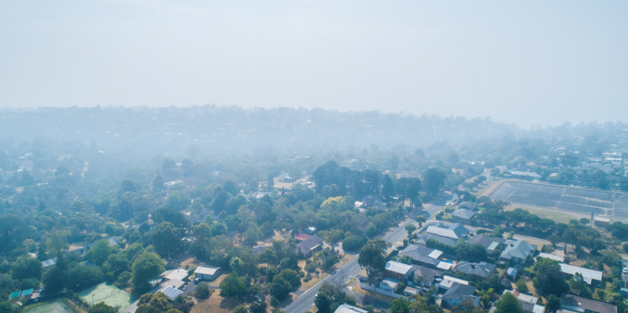
From an economic loss perspective, Thailand and the Philippines often come to mind when one thinks of countries most at risk from floods and typhoons within Southeast Asia. This is not unexpected, particularly with vivid images of the severity of events such as the Thai Floods in 2011 or Typhoon Haiyan in 2013.
However, the fact that Vietnam has not registered a multi-billion-dollar disaster of a similar scale in recent memory does not make it less prone to these risks.
The warning signs are increasingly ominous, with Typhoon Yagi in 2024 causing more than US$3 billion in economic losses, including disruption to key economic hubs in the North in Quang Ninh and Hai Phong.
Since Yagi, there have been repeated storms and floods that have caused severe impacts across the nation, causing devastating loss of life, crop failures and disruption (although so far avoiding key economic zones) with costs expected to exceed Yagi's toll.
Meanwhile, Vietnam's economy continues to grow at a rapid pace – evidenced by conglomerates such as Vingroup's growing production of electric vehicles and expansive real estate developments, which are now an omnipresent sight throughout the country.
Vietnam has also attracted significant foreign direct investment in recent years, in part driven by an effort to diversify from China. As such, a critical question to raise at this point is to what extent flood risk, particularly with ongoing climate change, threatens progress?
To this end, we review the 2025 typhoon season from a climate perspective as it applies to Vietnam to identify potential risk factors for the future and explore other non-climate factors such as land use change and the impact of a dense hydropower network across the nation's rivers.
We advocate for the need for an increased appreciation of risk at the grass-roots level and propose some solutions, including contributions from the insurance industry and actuarial profession on how to address the growing threat of floods.
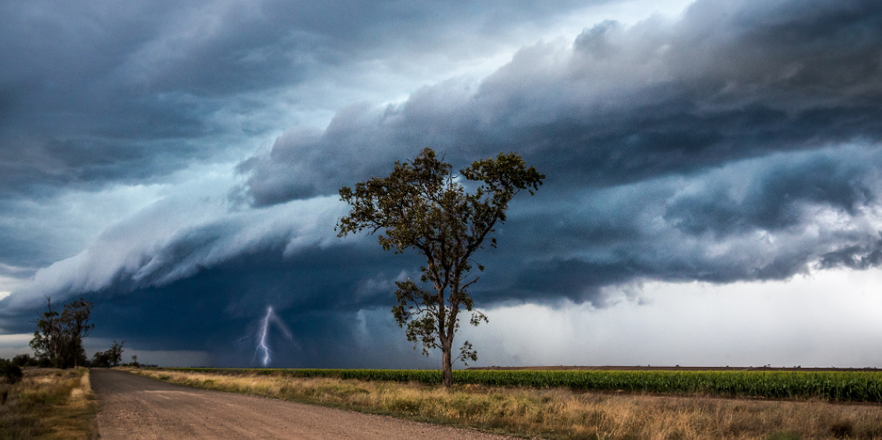
The spectacular run of flood events and associated impacts have not gone unnoticed, particularly with repeat impacts on tourist attractions such as the ancient cities of Hue and Hoi An.
While official climate extreme attribution studies have yet to be released, commentary to date has been focused on the impacts of a La Niña and a reinforcing negative Indian Ocean Dipole (IOD) phenomenon, which has contributed to elevated sea surface temperature anomalies (SSTAs) and hence increased moisture feed into weather systems within the Southeast Asian region.
However, there may be other drivers at play that have not been explored.
Central Vietnam typically receives much of its rainfall from the NE Monsoon from September until December, with major rain events coinciding with typhoon activity.
What made the typhoon season highly peculiar for 2025 was not the intensity of storms, but the number that formed (40 vs 25 on average (since the 1960s), direction of travel that followed a "Typhoon Corridor" that was heavily biased towards landfall in northern Philippines before tracking into Vietnam, and high amounts of rainfall associated with each system (see Figure 1), an important feature that cannot be attributed to typical natural climate variability such as El Niño-Southern Oscillation (ENSO) or IOD involves Sea Surface Average Temperature Anomalies (SSTAs) in different parts of the Pacific and Indian Oceans.

Figure 1: WikiProject tropical cyclone tracks 2025. Source: https://commons.wikimedia.org/w/index.php?curid=167482648
Apart from vertical wind shear conditions that created favourable cyclone genesis and intensification conditions, a persistent zonal wind (which blows East to West at the latitude band of interest (15oN – 35oN) was set up due to very warm waters East of Japan and South of the Bering Sea region, creating a mid-level ridge that effectively steered cyclones into the central to northern Vietnam region rather than recurving northwards.
These storms unleashed heavy rainfall upon landfall due to elevated SSTA across the South China Sea region. Elevated SSTAs do not always result in more intense typhoons as they primarily set the upper boundary for maximum potential intensity over the lifetime of a typhoon.
In 2025, only 14 storms intensified into typhoon-level strength categories compared to a historical average of 16 storms, with strength of winds diminished upon crossing the Philippines and interacting with local topography.
Doi Moi reforms since the 1980s have contributed to rapid economic growth – lifting millions out of poverty, but also leading to environmental degradation that makes Vietnam particularly vulnerable to floods, mainly through land use change, subsidence issues and hydropower development. (Source: Fan et al, 2019)
Land use change contributes to increased flood risk in several ways - both in places that have experienced the change, as well as other areas. Today, major cities such as Ho Chi Minh and Hanoi are increasingly covered with paved surfaces and buildings, significantly reducing the efficiency of natural flood buffers such as wetlands and floodplains. For example, urban sprawl in Thu Duc City has been linked to flood risk due to increased surface water runoff coupled with insufficient drainage (Source: Nguyen HTT, 2025).
Agricultural development, particularly in the Mekong Delta region, has also affected soil infiltration and absorption capacity - increasing the magnitude and duration of floods. Areas not directly impacted by urbanisation are also impacted due to more severe flooding upstream through backwater effects as the space for water to spread out during high-flow events is reduced.
Urbanisation aside, land subsidence is a major issue – particularly in the Mekong Delta and the Ho Chi Minh City (HCM) area - where reports show subsidence rates of 2-5cm per year. Akin to other Southeast Asia megacities such as Bangkok and Jakarta, HCM arises from excessive groundwater extraction and increased construction loads, making it more vulnerable to tidal flooding and prolonged inundation (see Figure 2).
Another major risk factor exists in the form of hydropower, which influences flood risk through sediment trapping and flow changes.
To counteract natural subsidence and erosion, delta land elevation and riverbanks require sediment delivery for replenishment, but dams prevent this process from happening. The Hoa Binh Dam (built in 1988) is a prime example of this blocking effect, preventing sediment from flowing down the Da River, which is a major tributary that feeds the Red River Delta.
In addition to its role in slowly building up flood risk downstream, during the October 2017 tropical depression event, the emergency release of water from Hoa Binh Dam further contributed to exacerbated downstream flooding.

Figure 2: Sea level rise impacts to areas under a pessimistic climate scenario – shaded area denotes area below tideline – details and limitations of estimated impact areal extent can be found at Coastal Risk Screening Tool webpage. Source: Climate Central.
Climate change serves as a threat multiplier in Vietnam through increased rainfall to the region. Sea level rise, together with subsidence, increases inundation risk and other knock-on environmental issues. These include saltwater intrusion, which impact rice production due to freshwater scarcity and and exacerbate infrastructure damage (Source: Xiao et al., 2024).
As evidenced by the 2011 Thai Floods, higher sea levels also impact flooding across the nation by slowing discharge out of river systems, leading to longer inundation times. (Source: Jular, 2017).
With a long history of floods, the Vietnamese government officially recognises flood risk as a major natural hazard and has explicit risk management frameworks to address it through prevention and early warning systems.
More recently, the government has also released the National Climate Strategy and Adaptation plan to 2050, acknowledging the growing threat of climate change.
Public perception of floods remains mixed and at an industry level, appreciation of flood risk remains relatively low. This becomes a concern as Vietnam is increasingly positioned as a manufacturing hub and supply chain base. Risk-based pricing of assets by insurers is not widely implemented and rates may be artificially suppressed through the prevalence of tariffs.
Strengthening risk awareness of both flood climate risk impacts more generally is critical and underpins the development of effective solutions. As disaster risk experts, actuaries and the insurance industry at large is in a unique position to support the following:
Improved and sustained risk awareness can enable real (and often difficult or unpopular) decisions and solutions. For example, more mature insurance markets that reflect real underlying technical risk may compel the development of innovative risk transfer such as parametric risk solutions.
Heightened awareness can also drive more rigorous flood risk governance and add checks and balances to the approval of new developments by considering exposure to flood risk, or prioritise flood risk mitigation through revised budget allocation and scrutiny over budget spend.
Fan et al., Urbanization, economic development, environmental and social changes in transitional economies: Vietnam after Doi Moi, Landscape and Urban Planning, 2019
Garner et al., Changes to tropical cyclone trajectories in Southeast Asia under a warming climate, Climate and Atmospheric Science, 2024
Jular P., The 2011 Thailand Floods in the Lower Chao Phraya River Basin in Bangkok Metropolis, Global Water Partnership, 2017
Luong H.D. et al., Impacts of Climate Change and Land Use Change on Flood Flow in the Ca River Basin, Editions AFD, 2025
Nguyen, H.T.T. et al., Assessing the Risk of Inundation in Thu Duc City using an Integrated 1D-2D Hydrodynamic Model with a Combination of Boundary Conditions Defined by Probability Analyses, JWMM, 2025
Nguyen H. et al., Forest dynamics mapping in central Vietnam from 1988 to 2022 using Landsat time-series data, Environmental Research Letters, 2025
Sasges and Ziegler, We have eaten the rivers: the past, present and unsustainable future of hydroelectricity in Vietnam, Sustainability, 2023
Vietnam estimates damages of $3.31bln from Typhoon Yagi, Reuters, 2024
Xiao H., et al., Numerical Modeling for determination of the dominant factor inducing saltwater intrusion into shallow aquifer in the Mekong River Estuary within the Mekong Delta, Vietnam, Sustainable Horizons, 2024
This work is licensed under a Creative Commons Attribution-NonCommercial-No Derivatives CC BY-NC-ND Version 4.0.
Receive industry-leading perspectives, straight to your inbox.