Australian Actuaries Climate Index Frequently Asked Questions
Explore our FAQs to understand how and why the Index was developed and more.

Frequently Asked Questions
Have any more to add? Get in touch with us below!
The Australian Actuaries Climate Index (AACI) refers to a number of indices that provide objective measures of historical extreme weather and sea levels. It is intended to provide a useful monitoring tool of climate trends.
The AACI includes a series of component indices and a composite index.
- The component indices show changes in the frequency of extreme levels of each of temperature (high and low), rainfall, consecutive dry days as a measure of drought , wind and sea level.
- The composite index combines the measures of high temperature, rainfall, wind and sea level into a single index.
The Index is available nationally and across 19 regions in Australia. The AACI is updated quarterly as data for each meteorological season becomes available.
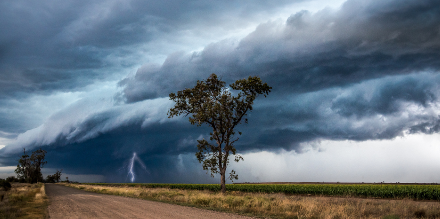
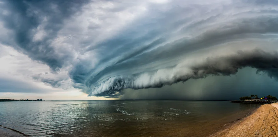
The AACI is designed to help inform actuaries, public policymakers, companies and the general public about climate trends in Australia. The focus is on the extremes, which are related to risks such as inland and coastal flooding, cyclones, drought and heat waves. Hence the indices are intended to add to our understanding of how certain risks may be changing as a result of climate change.
Actuaries are experienced in assessing and managing the financial consequences of risks and in analysing complex data and presenting insights. Many of the organisations that actuaries support are concerned with climate risk and how it will affect their operations – for example, local and state governments, general, life and health insurers, banks and investment managers. The Index is intended to provide a useful measure of how the extremes of weather are changing in order to support assessment of the change in risk.
Currently the link to risk is implicit rather than explicit. In the future, additional indices measuring specific risk attributes could be developed by looking at the relationship between the data on extremes and historical risk data. For example:
- risk of damage to property
- risk of damage to health
- risk of excessive energy demands.
The Index examines changes in the frequency and duration of extreme temperatures (high and low separately), heavy precipitation, consecutive dry days (as an indicator of drought), strong wind, and changes in sea level. The Index is available for 19 regions of Australia. For each of these, a component index is created with the time series beginning in 1981.
The component indices are based on the ERA-5 reanalysis dataset from Copernicus, the Earth observation component of the European Union’s Space programme. It is a global dataset that is used by researchers across disciplines to study weather, monitor climate variability, and support climate model evaluation.
All data is compared to measurements over the 30-year reference period of 1981 to 2010. The data is summarised by meteorological season (three months ending February, May, August and November), and a 5-year moving average was selected as the key metric.
The six components are:
- frequency of daily maximum and minimum temperatures above the 99th percentile (high temperature)
- frequency of daily maximum and minimum temperatures above the 1st percentile (low temperature)
- frequency of rainfall over five consecutive days above the 99th percentile
- seasonal maximum consecutive dry days
- frequency of daily wind speed above the 99th percentile
- seasonal maximum sea surface height.
The composite index, the AACI, reflects a simple average of the high temperature, rainfall, wind and sea level indices. It is intended to bring several of the components into a single headline measure. The low temperature measure was excluded so that temperature was not overweighted in the composite index. The consecutive dry days measure was excluded as it shows a strong inverse correlation with the rainfall measure - i.e. low rainfall is naturally associated with consecutive dry days.
The composite index reflects a simple average of the high temperature, rainfall, wind and sea level indices
The regions are primarily based on the administrative National Resource Management regions, which have been aggregated to create 19 regions. Further modifications were made to Western Australia, Northern Territory and North Queensland to better capture the variation between inland and coastal regions.
A positive value in the Index represents an increase in climate-related extremes relative to the reference period.
The value is expressed as a standardised anomaly. This means that for an individual component, the standardised anomaly corresponds to how unusual that season’s value is compared to the reference period mean (average) and standard deviation for that season. Hence each component is in units of the standard deviation of that quantity (e.g. an index of 0.5 means the component has increased by half a standard deviation).
The higher the value, the further the component is from its reference period mean. A positive value indicates the frequency of extremes has increased. A negative value indicates the frequency of extremes has reduced.
Using standardised anomalies allows us to combine underlying components in a consistent way relative to their natural variability.
The data is derived from ERA-5 and ORAS5 reanalysis datasets from the European Centre for Medium-Range Weather Forecasts (ECMWF) as part of the Copernicus Climate Change Service (C3S). More specifically:
- The land-based components (temperature, rainfall and wind) use 11,154 gridded points at approximately 31 km intervals across Australia.
- The sea-based component (sea level) uses 174 points within 3 kilometres of the coastline.
We expect the Index will be useful to anyone interested in understanding how climate change is leading to changes in risk.
This would include organisations that are seeking to make climate related disclosures in their financial statements and who may want to be tracking measures that are linked to risk.
At this stage, given the indices are linked to risk, but do not explicitly measure risk, we would expect them to be used as highlighting areas where the risk may be higher or lower. We would not expect the indices to be used to directly price risk (such as setting insurance premiums) since they are not based on risk measures but are correlated to them.
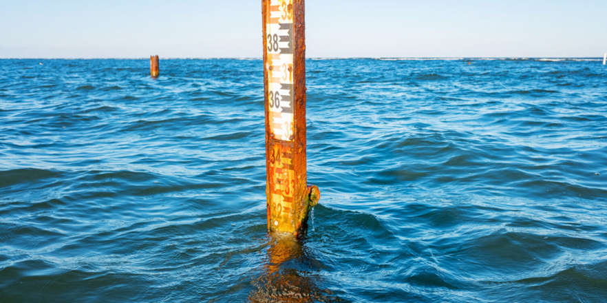
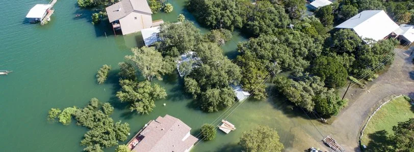
The Index indicates that the extremes of temperature and sea level have increased relative to the reference period. The sea level index shows particularly elevated results along the east coast of Australia. This aligns with the 2024 State of the Climate Report , which found sea level rise has been especially pronounced off New South Wales, and with the first National Climate Risk Assessment , which warns that by 2050 more than 1.5 million Australians could be exposed to coastal flooding risk.
Both higher and lower temperatures have the potential to provide challenges. We have chosen to show the increase in the 1st percentile of temperatures as an increase in the Index and hence linked to higher risk. The higher 1st percentile temperatures are associated with, for example, increased propagation of diseases, pests and insects that were previously less likely to survive in lower temperatures.
The AACI is based on historical data. It does not attempt to forecast future changes in the frequency of extremes.
A similar index ( the ACI ) has been constructed by the actuarial societies in North America to show the trend in climate extremes across North America. The AACI and ACI are not directly comparable. The key differences between the AACI and the ACI are as follows.
- Reference period: The AACI uses 1981 to 2010, whereas the ACI uses 1961 to 1990. A more recent period means better quality data and a more contemporary view of changes in risk.
- Definition of exceedance threshold: The AACI uses the 99th percentile whereas the ACI uses the 90th percentile. A more extreme threshold provides a better link to risk (refer to the separate Sample Calculations document for further detail).
- Wind: The AACI is based on the maximum wind gust each day. The ACI uses the average wind speed over 24 hours.
- Composite index: The AACI is based on only four component indices, not all six. The ACI includes all six of its component indices (and therefore including low temperature, which is measured in a different way, and consecutive dry days).
Latest AACI articles


Australian Actuaries Climate Index
Component graphs and data
Explore the AACI via interactive graphics and downloadable data.
Questions? Comments? Want to get involved?
Contact us about the Australian Actuaries Climate Index today. We’d love to hear from you.
